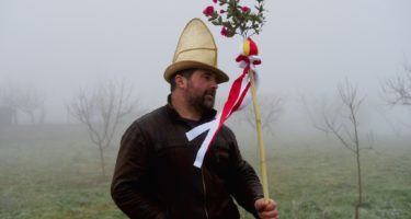
Earlier this month me and Zé Paulo returned to the International Tagus Natural Park (Tejo Internacional, in Portuguese), the protected area where Tagus river enters Portuguese territory. This time our aim was to photograph some deer during rut on a short weekend trip, and this time we brought Ruben with us. It was successful in many ways, spending time with friends in one of my favorite spots in the country is always a win-win situation, but not photographically speaking, despite having a young stag jumping just ahead of us the opportunities to photograph them were few. That moderate success and aggravating weather conditions made us return home earlier than expected.
Early in the morning, after the guys left, my obvious choice would also be driving home through the modern highways to arrive at lunch time, and spend the rest of that rainy Sunday comfortably watching a movie or doing any other lazy Sunday activity. Rapidly another idea formed in my head: return slowly, using the old secondary roads, but not the traditional route to Lisbon used by people from that region for decades, that takes a big shortcut through the long, straight roads of Alentejo.
My plan for the rest of that day was slightly different, drive along what that region had in common with my hometown: the river, as seen from the road.
The Tagus splits Portugal in two, flowing for 300 Km in Portugal (its total length is 1000 Km) before its waters end their journey in the Atlantic ocean. Driving mostly the EN118, the road that follows it almost from the place where the it enters this little rectangle shaped country to the place where it abandons it. In that distance, and despite it’s a short distance, it passes through different perspectives of the country. The upper Tagus in the Beira Baixa region is made of rocky cliffs in narrow valleys, perfect for birds of prey to build their nests, one of the reasons the reasons, a relatively untamed area like many other of the border regions in the country. Then the lower Tagus region becomes a vast farming land, that also takes its name from the river: Ribatejo, often flooded by the same river that makes those lands the most fertile in the country before meeting the suburban cities of Greater Lisbon.

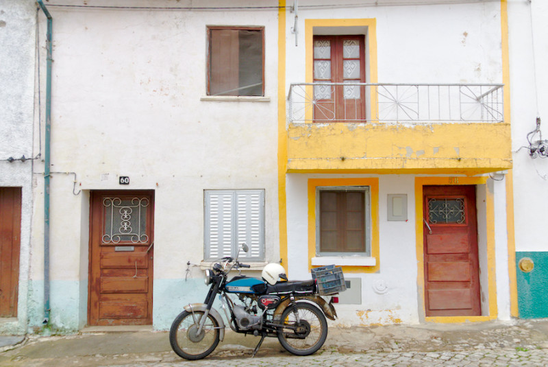
A 35 year old two-stroke motorcycle parked at Rosmaninhal

Minor road that crosses the International Tagus Natural Park

Small village of Cegonhas (Portuguese word for storks) in the International Tagus Natural Park.

A house for sale in a small village still in the International Tagus region. If interested don’t forget Portugal’s dial code is +351.

Empty bench outside Malpica do Tejo’s cemetery, one of the villages that takes its name from the Tagus river.

Bridge over the Tagus river, close from where it definitively enters Portugal’s territory after the 50 Km where it forms the border with Spain.

Old distance signs on an abandoned maintenance storage house close to Vila Velha de Rodão.

Empty strech of road heading to Abrantes

Detour at Alvega

Alvega

Home match of the local team close to Abrantes

A colorful chimey of the Pego power plant, built close to the Tagus outside Abrantes

Patches in the road with a corn field nearby Constância

Almourol, one of the many castles along the Tagus (very important during the Reconquista) and the place that marks the change to plains and flooding lands, to a much more humanized landscape.

Posters in abandoned house at Ribatejo, the region that lives and breathes the bullfighting culture in Portugal.

Sunday afternoon TV show at a roadside restaurant close to Chamusca

Getting closer to the Sorraia basin, one of Tagus’ affluents, the most fertile lands in the country start to change the landscape.

Farming land until the eyes can see.

Dog at empty bus stop by the road in RIbatejo

Once a highly reputable inn but abandoned for 20 years, in the middle of “Recta do Cabo”, the 10 Km straight road that crosses the plains around Porto Alto. The last stop before Greater Lisbon (or first, depending the direction).

Under the Marechal Carmona Bridge

The old bridge to Vila Franca de Xira, that also marks crossing from the rural “other Portugal” to the metropolitan Greater Lisbon.


Leave a Reply